Are you interested in digital mapping tools for your smart phone or tablet? Here are a few resources to help you get started or improve your skills.
First, let’s make sure you are getting the most out of the map app that came with your smartphone or tablet. When you open your map app you will see a dot showing your present location, which is determined using a combination of GPS satellites and cellphone towers. This technology is called Assisted GPS. The location dot shows up on a basic map layer displaying roads and waterways.
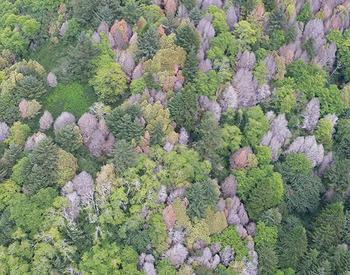
You also have the option of switching the base layer to satellite imagery by using the small icon in the top right of the screen. In Apple Maps this is an “i” symbol and in Google Maps it is a little box-like symbol. Satellite imagery is a great tool for looking at landscape features on your property. Zoom in to see the difference between conifers and hardwoods and even different sizes of trees.
Pins, or marked locations, are a useful feature. They allow you to save the location of a point of interest on your property for future reference. You can do this by holding your finger on the screen at the desired point and following the pop-up menu options to give the point a unique name. In Apple Maps a “save to” menu option will appear. In Google Maps, you’ll be prompted to sign in to “save” or “label” the dropped pin location.
You might drop pins at culvert locations or in an area with a root rot pocket. If you are taking stocking surveys to measure reforestation success, drop a pin at each stocking survey plot. Just remember, the accuracy of your phone GPS is not as high as the better-quality GPS units, but it should be good enough to allow you to find the point again. To re-locate the point, select the dropped pin and follow the general navigation directions back to the point. Make sure to carry a paper map and compass if you are not familiar with the terrain.
A number of apps are available to download from your trusted app store if you would like to explore additional digital map options. Avenza Maps is an example of a free app that gives users access to a map store where they can download a wide range of map resources including recreational road maps, trail maps, topographic maps and maps with aerial imagery. Many maps in the Avenza Maps store are free while others require purchase. Once a map is downloaded to a device, Avenza Maps does not require a cell signal or internet connection to function, making this a useful feature for many forest management activities.
There are a variety of ways that you can use Avenza Maps to help manage your property. Maybe you want to map general locations of trails, roads, property boundaries or harvest unit boundaries to help you better understand the layout and features on your property.
Using the “record GPS tracks” feature, you can record the path that you walk or drive. As you travel, the GPS will be enabled and record your tracks on the map. For example, while you’re out on your land, you might come across a feature not displayed on an aerial photo, like a recent patch of blowdown. You can turn on GPS tracks and walk the boundary of the blowdown patch. Later, you can use the “draw and measure” tool to trace your tracks around the blowdown to calculate the total area of the patch. (In the paid version of the app, Avenza Maps can calculate area based on your tracks, saving you a step.)
You can store multiple tracks as different layers on a map, allowing you to see all the different features where you traveled on your property. Recording your tracks will also allow you to record total distance, average speed and elevation changes while you map out property features.
Another useful tool Avenza Maps provides is the ability to draw and measure on the map. You might want to measure the distance between two points if you’re out on your property and wondering how much farther it is to the next ridge, property corner, road or other feature you’re looking for. Using the “measure distance” tool, you can find out just how far it is to your destination. Avenza Maps also allows you to draw on the map while you’re in the field. This can be used similarly to the “drop pin” feature, where you can note areas of interest.
Avenza Maps also has a “plot photo” feature that allows the user to link a digital photo to its geotagged map location. This would be a great way to record the images of various projects like thinning, planting or erosion problems.
For more information on Avenza Maps, visit the Avenza Maps website or download it from your smart device's app store.
Trade-name products and services are mentioned as illustrations only. This does not mean that the Oregon State University Extension Service either endorses these products and services or intends to discriminate against products and services not mentioned.