In our first article of this series, we gave an introduction to a few digital mapping applications, or map apps. We will continue our discussion of digital map resources and applications in future articles, but first we want to highlight the value of paper maps and how you can print out a topographic map from a digital source.
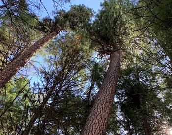
Many woodland owners, hikers and forest professionals are familiar with the United States Geological Survey topographic maps, also referred to as 7.5 minute quadrangles, or, “quads.” People use them to navigate their woodlands, hiking trails or work locations. Either tacked to the wall, rolled up and kept in bin in the corner for future reference, or carefully folded up and carried in your backpack, USGS maps were once the standard navigational tool.
This high use is due to their high quality of mapping and standardized symbols, which represent a wide variety of landscape features including hydrology, vegetation, geologic features and human-made structures. These symbols and contour lines give you an indication of the lay of the land and can also be used to estimate slope.
The classic USGS topographic quad sheets were printed with a scale of 1:24,000, where 1 inch on the map represents 24,000 inches (or 2,000 feet) on the ground. Each map represents an area approximately 49–70 square miles. A number of other map makers produce maps based on the USGS topography that cover larger areas, eliminating the need to carry multiple USGS topo maps. Many of these maps are made with waterproof and tear-proof materials, which are invaluable features in our moist Oregon climate.
Digital devices with map apps seem to be replacing the use of the printed maps. As we discussed in Part 1, map apps have some really handy features such as showing your location, creating pins marking places of interest, attaching photos and more. But we will always remind you to carry a paper map as a backup in case your cell phone or tablet battery runs out or if you drop your device in a creek.
Can you still buy paper maps? Yes! You can buy them in recreation stores, some hardware stores, federal or state agency field offices, or online. But it can be handy to quickly print out a map on a home computer ,too.
Although there are a number of sources for online topo maps, an important consideration is making sure that you understand the scale on your printed maps. Knowing the scale is important because the scale represents the relationship between the distance on a map and the distance on the ground. Some digital maps can be printed out at the traditional 1:24,000 scale. On these, it’s easy to check that the map printed correctly by placing a ruler up to the scale bar and making sure that the segment representing 2,000 feet measures 1 inch (Figure 1).
If you would like to print out a topo map with a 1:24,000 scale, visit USGS’s topoView. USGS topographic maps originally published as paper documents between 1884 and 2006 have been scanned and are available to download free of charge through topoView. TopoView allows users to view current and historical maps for areas of interest. This can be incredibly useful to learn about the history of an area and find the names of natural and cultural features that may have changed over time.
To view available maps for your area of interest, select “get maps” from the top menu bar, enter your desired location and select a map from the list. View the map list in order by date, scale or name of the map. To print a map from topoView:
- Download the map in GeoPDF format.
- Open in Adobe Acrobat.
- Select Poster size.
- Select tile scale 100%.
The map will print out in nine letter-sized pages that you can tape together. View the online video instructions to learn about more features of the topoView website.
National Geographic has free topo maps available online for the public as well. These USGS 7.5 minute topo maps can be printed on letter-sized paper on any printer. These topo maps are scaled to print on four pieces of paper that you can tape together to see all the original features that would be displayed on the traditional printed USGS topo maps. It’s important to note that these maps are not printed to a 1:24,000 scale; the user needs to note the scale printed out on the maps.
Once you have printed out your paper map, another handy step is to slip it in a plastic page protector case and tape the top closed. This will help keep the map dry and prevent any moisture damage from your treks through the woods. You can also fold the map and slip it in a gallon-sized sealed plastic bag. If this is a map you plan on using frequently, laminate it. A laminated map is a handy tool because you can write on it with a dry-erase marker to notate important features you discover, then later transfer these to a paper or digital map in your forest management plan. This allows you to keep reusing the same map and saves you time and resources by printing it only once.
Stay tuned for our next article in this series where we will explore more mapping apps and how to use them.
Trade-name products and services are mentioned as illustrations only. This does not mean that the Oregon State University Extension Service either endorses these products and services or intends to discriminate against products and services not mentioned.