Transcript
From the Oregon State University's Extension Service, you are listening to In the Woods with the Forestry and Natural Resources Program. This podcast aims to show the voices of researchers, land managers, and members of the public interested in telling the story how woodlands provide more than just trees.
They provide interconnectedness that is essential to your daily life. Stick around to discover a new topic related to forests on each episode. All right. Welcome back everyone to In The Woods Podcast, presented by the Forestry Natural Resource Extension Program at Oregon State University. I'm Jacob Putney, extension agent in Baker in Grant counties, and your host for today's episode.
I'm excited to be joined today by an extension colleague and friend, Dr. Katie Wollstein. Katie is the Rangeland Fire Specialist with the Extension Fire Team and is based at the Eastern Oregon Agricultural Research Center in Burns. She recently completed her PhD at the University of Idaho, and prior to that she was at Oregon State where she completed her masters.
Katie, it's great to have you on. Thank you so much for joining us. Why don't you tell us a little bit more about your background and some of your work? Thanks for having me, Jake. Um, so I grew up in the west. I grew up in Washington State and I've worked in several states, um, in, in Rangelands. And, um, my, my research and outreach with OSU Extension is primarily focused on, um, you know, how do we manage rangeland resources effectively.
And so a lot of that is kind of this tension between, you know, top down versus localized solutions. And some of that has been exploring social and policy conditions. Um, in this current position for mitigating fire risk or cross mixed ownerships, which characterizes a lot of our rangelands in Oregon. Um, and then also just collective arrangements for managing public goods such as wildlife and fire resilience.
And so that's, you know, how do we effectively work together in these spaces and, and, you know, serve kind of the multitude of values that Rangelands are meant to support. And so within, uh, the OSU Extension Fire Program, my research and outreach aims to assist the ranchers in this space. Um, the federal land management agencies, state agencies, other range and stakeholders, um, in being able to leverage their different tools and assets, their capacities, um, their types of knowledge to enhance, uh, social and ecological resilience to events like wildfire.
Well, we try to cover a wide range of topics on this podcast, and if you couldn't have guessed it already, and if you're familiar with Southeast Oregon, you're probably familiar with the rangelands. So that's what we're gonna cover today. So Katie, why don't we start off with a little bit of background on range.
So what defines the rangeland and where are these ecosystems found, let's say in Oregon? Well, first I'd like to assert that for this episode, you should change the title of your podcast from In the Woods to Out of the Woods. My 2 cents there. Um, and so rangelands have been really broadly defined and, and I think the, the public in general struggles to understand what this is for that reason.
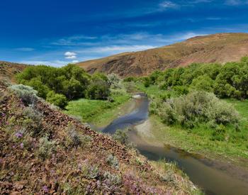
Um, they're found all over the world. Uh, rangelands actually encompass almost half of the Earth's land surface, and they're usually characterized by, uh, limited precipitation. So for example, here in Harney County, we get between 10 and 15 inches of precipitation a year. There's often sparse vegetation in these places.
Um, climatic extremes. So where we are really cold winters, really hot summers, uh, highly variable soils, um, and diverse, amazing topography. And so terms that folks may have heard that, that include rangelands, uh, are prairies, plains, grasslands, deserts, uh, arids, semi arid lands, steppe, shrublands, um, some woodlands.
Some savannah, and then I'll add that, uh, 42% of Oregon's land area is actually classified as rangelands. And this is mostly sh rublands and, um, grasslands, um, some woodlands. And here in southeastern Oregon, we're in the Northern Great Basin. In particular, this is sagebrush steppe. And so we have an awful lot of, um, sagebrush.
And then also you see an understory of bunchgrasses and, and also forbs and in general, rangelands, um, are important for, uh, wildlife habitat. So in the Great Basin, which I just mentioned, it's home to 350 species, uh, that are specifically adapted to Rangelands. And so that includes pronghorn antelope, um, pygmy rabbits, greater sage-grouse, mule deer, badgers, moose, elk, sage thrashers. Rangelands, also provide for watershed function, recreation.
I think a lot of folks know that Central Oregon and Eastern Oregon offer some great opportunities and also just they're known for their vast open space. And so for some perspective on that, uh, 60% of the sagebrush ecosystem is actually in federal land ownership. What this means is those lands are held in trust for the American public.
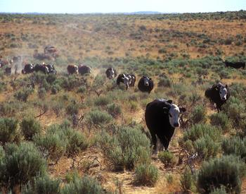
So, so they're meant to be enjoyed, undeveloped, you know, serve multiple uses. Um, the, the last, um, reason rangelands are important is for ranching. And so that's a major economic activity on these lands. Um, and, and so this is why when you go out to Eastern Oregon, you see a lot of cattle and sheep.
I live in an area with a lot of range, but admittedly I do not know a whole lot about range.
I've spent most of my time driving through it to get to the forest. Uh, so you mentioned fire, I heard greater sage grouse in there, and you also talked about ranching. So why don't we talk a little bit about how these lands have been influenced by, say, disturbance use and uh, management.
Yeah, appreciate you kind of highlighting those, those three important, uh, symbols of, of range.
So, you know, a, a lot of people might, might be aware of this, but rangelands are, are under threat from a couple things. So we have these land use effects that have compounded over time, obviously climate change, which affects a lot of lands. Um, and this has resulted in some changes to our fire regime.
So we're seeing conifer expansion, primarily western juniper, um, at lower elevations. And I'll get to why that's happened and why that's a problem in a second. Um, and then the second piece of this is the proliferation of invasive annual grasses. And so prior to the late 1800s, uh, recurrent fires varied in frequency and severity across rangelands.
Um, and so it produced kind of this, these natural burns produced what we call a mosaic, where we had kind of in on unburned sage brush and interspersed grassland communities. And, and so you had different stages of plant communities providing for different habitat needs, different, you know, forged quantity and quality.
And so you had no single enormous block of landscape primed to burn at once. Today we have too many frequent and severe fires in some places, and then we have not enough fires in others. The reasons for this. Um, so first, uh, the introduction of invasive annual grasses to North America. Um, it's, it's a tricky one.
So these grasses, um, are really happy here. They're really well adapted to germinate really quickly, especially after disturbance. And so what has happened in areas that, you know, start to get a little bit, um, colonized by invasive annual grasses. So for us, this is Cheatgrass, Medusahead and Ventenata in Oregon.
Um, and, and those grasses, um, create really contiguous layers of, of fine fuels. And so what this means, and this is born out in, um, the science, that there's actually a higher probability that an ignition will, uh, propagate and quickly spread a fire from an invasive annual, grass dominated area. And so what we've seen over time is we are having more frequent and then also larger fires due to the presence of those species on this landscape.
And then the terrible thing is that's self-reinforcing because as I mentioned, those annual grasses, um, are, you know, their happy place is right after disturbance. And so as you could imagine, if you have, you know, some vast expanses of bare soil after a fire, and a propagule source. Then those grasses will come in and further invade and potentially exclude perennial bunch grasses, which means you're further vulnerable to more fires.
And so it just keeps reinforcing itself. So we call that the um, invasive grass fire cycle. And so we have that going on in Rangelands. And then at higher elevations, I had made this reference to conifers. And so one thing that has happened over time, uh, with land practices like grazing is so, fires historically, um, burned at those high elevations where western juniper used to, um, primarily be found.
So kind of rocky outcrops, poor soil. But if you don't have fuel to carry fire up to those sites, so grass. So if it had been grazed, those fires ceased reaching those elevations. So we have denser and denser conifers that are creeping lower and lower into the landscape. And so our Eastern Oregon rangelands are kind of being crunched between this, um, spreading of western juniper conifers, where they didn't used to be, which increases fire severity, um, in those places, or kind of uncharacteristic, fire severity I should add. And then also we are having just more frequent fire, uh, because of the invasive annual grass problem. So it's kind of wild out here.
Um, just just for some perspective, um, last fall, so in 2022, uh, the US Geological Survey released a report, uh, led by Kevin Doherty with, uh, the US Fish and Wildlife Service, and, and they found that 1.3 million acres of the sagebrush biome in North America is transitioning each year from largely intact kind of sagebrush sites.
To, you know, what they've characterized as other rangelands, so in some kind of degraded quality. And so this is a result of kind of those, those different, um, the, the results of those different land use effects. Again, climate change, conifer expansion, and those invasives. So it's quite dramatic out here.
Yes, it sounds like it. So, uh, thinking about the feedback loop of those invasive grasses and, um, some of those other challenges like conifer encroachment, how does that influence or how does that drive decisions? Um, management decisions of range lender or restoration of some of these ecosystems?
Yeah, appreciate that question. Um, I mean, my, my immediate response is it shouldn't drive it, right? We, we don't wanna be in a space where we're reacting to problems. We wanna be proactive and prevent this ecosystem from reaching those points, right? Because what we've learned from invasive annual grass kind of proliferation out here is a lot of times, um, once we lose those sites to invasives, it is super hard to get it back.
And so in response to, you know, how are we handling disturbance? How are we managing rangelands? What are we thinking about when it comes to restoration? Um, I, I'd say we need to think our, sh our, uh, shift our thinking from reactive to proactive management. But this is super hard. There's a reason we aren't currently doing it, and, and it's for a couple reasons.
Um, so first off, we're in a really complex land ownership scenario. Um, on, on rangelands in particular. And so as an example, 75% of Harney County is public land. And if you take a good look at, uh, an ownership map for Eastern Oregon, a lot of this land is what we call checkerboard. I'm, I'm sure you've talked about that before in this program where you have this intermixed land ownership situation.
And so you can imagine, you know, wildfire occurs on the landscape scale. Um, but if you were a landowner with just a 640 acre parcel or maybe a couple, couple parcels here and there, it's really, really hard to take on management activities that translate to that larger, that landscape scale. And so, you know, in terms of responding to these challenges, and you'd mentioned restoration, we need to be thinking again at that larger scale and figuring out how do activities, um, you know, within our sphere of influence.
So whether that's an individual ranch, whether that's even a pasture, um, whether that's some other parcel. How do the activities we do there aggregate over, uh, larger spatial scales, but also importantly over time. And the reason for this is actually, um, fairly unique to Rangelands. Um, and so a study came out led by Joe Smith, the University of Montana last year that showed that rangeland fires these, these large fires.
So those are classified as a hundred thousand acres. They're actually driven by annual fine fuels production. So when we have big grass growing years, we have big fires. Um, there's usually a two year delay. But in general, that's the pattern that's been observed. And so, as you can imagine, I'd mentioned, um, you know, climatic variability is, you know, a defining characteristic of range.
What that means is our fine fuel production also dramatically varies from year to year. So if you are a manager or even a rancher trying to plan and kind of manage your fine fuels to manage your fire, it's really hard to know where exactly you need to deploy treatments every single year, because it's extremely likely that the same treatments are not appropriate in the same place in every year.
So how do we figure out how to do that nimbly and, you know, be adaptive over time. So that's, that's the biggest challenge on Rangelands in addition to that ownership situation.
I think you kind of alluded to it already, but, uh, thinking about things like climate change and being more proactive and increasing pace in scale, how do you see some of these dynamics changing into the future, though?
Yeah, appreciate that question. Um, you know, it's hard because like I mentioned with the different, different land ownerships, also the way we fund our, our projects on Rangelands, it's, you know, people wanna feel like they're getting something done. And as I mentioned before, we we need to be operating a space where we are actually preventing something from happening, right?
Whether that's, um, invasion of annual grasses or that big fire. So returning your question, how do we do this? Um, it's working at that relevant scale. It, we can't just keep working at kind of this project scale or parcel scale. I know that's difficult because that's, um, you know, the scale at which ranchers are typically planning and operating.
That's the scale at which maybe NRCS is funding those projects. But we need to be thinking about working together in these larger areas. And then what we do in those larger areas is, thinking about all of the different tools on the table for rangeland management, so different fuel treatment options, um, and then deploying them where and when is appropriate.
And so this needs to be strategic, this needs to have kind of a really long timeframe, right? Because like I said, even though the challenges are different from year to year, the overall, um, effects of these, again, um, of whether we take actions or not. Those effects aggregate over time. So, thinking about, again, the pace and scale and the tools and things like that, uh, what research are you and other colleagues currently working on to address some of this?
I know you mentioned some, some of the research already, but what else has been going on to, to tackle some of these big issues? Yeah, so I, I wanna return to, to what I poorly said a few minutes ago. So this need to shift from a reactive to a proactive approach. And so what that means is rather than simply suppressing fires, treating invasive annual grasses or opportunistically treating fuels when we get money to do it, um, and then trying to keep up with post-fire rehabilitation.
Um, we need to think about addressing the underlying causes of the threats to ecosystem resilience and their effects on fire regimes. Um, so how do we do this? We've been developing some principles for strategic landscape planning to reframe the issue.
Um, to this whole, we are preventing bad things from happening. Um, and so, uh, listeners may, may look into Oregon's geographic strategy. Um, this has been led by the Sage Grass Conservation Partnership, and this is the idea that we can identify core rangelands, which are defined by different, um, specific vegetative conditions. And then we can also identify opportunities to grow those core rangelands.
We also know where impacted rangelands, so perhaps dominated by annual grasses, have a really low likelihood of being restored. And so we want to be thinking about mitigating those impacts. But the difference between a reactive and proactive approach is instead of mitigating those impacts and trying to rehabilitate those lost rangelands. We focus on the good stuff, those core range lands, we focus on building and growing around those and then potentially linking together those, um, you know, tracks of, of what is good.
Because the idea is if we can enhance resilience, um, then we can, uh, we won't see this invasion of annuals necessarily. We won't see these frequent large fires. And so there's a need to make sure that all of our activities are strategic and in support of kind of these big picture objectives. And so how do we do that?
So we've been developing, um, a strategic planning framework for aligning all our different activities. So how do our parcel scaled or short-term activities aggregate at that larger spatial and temporal scale? So one example of a tool, um, that can help groups do that are, um, potential operational delineations or pods.
Some folks may find that term familiar because it comes from the fire management space, but it's, um, mostly been applied, um, in forested systems and again, more in the fire response, uh, space, but we, uh, the Harney County Wildfire Collaborative have adapted pods for rangeland systems, um, specifically to use these individual units that all kind of aggregate a large landscape and thinking about how for each unit or activities, before, during, and after fire will influence, um, you know, what happens in the long term for that landscape.
So how do individual pods influence surrounding pods and collectively, how do those pods translate to landscape resilience to fire? And so it's been a huge learning process. Um, this, this type of planning framework, um, it has required a bunch of different people to come to the table.
One of our big wins has been, for example, so, um, the Bureau of Land Management, BLM, obviously they can only treat, um, fuels where they have NEPA clearance. And so making sure that lines up with kind of our goals and objectives. Um, that are embedded in the use of pods. And so one of our big wins has actually been on the private land side.
So we've had the Soil and Water Conservation District and the Natural Resource Conservation Service in Harney County, um, think big picture. And so they saw an opportunity to fund landowner projects along, um, important pods in the project area so that we can bring those private landowners along with this idea that again, those individual activities that are funded to, um, improve range in health in that area will also translate to large scale range in resilience.
So kind of on that, that note, I had a kind of a question I was thinking of is, what are some of the challenges that you see with kind of the, in the collaborative partnership space or the co-management space, uh, in terms of, uh, getting to that work done and the interactions between agencies, individuals, private landowners, ranchers, and things like that.
Mm-hmm. I really appreciate that question because this isn't unique to Rangelands. So, so two things, probably more than two, but we'll start with two. So the first is in a space where there is this mixed ownership that I've emphasized. Everyone or every organization is working with, you know, different timelines, different budgets, different organizational objectives, different disciplinary expertise, um, maybe different metrics for success.
And so how do you align all those, um, in a timely and relevant way within a project area? That is hard. Um, and we certainly aren't gonna change, um, how organizations like BLM does business. And so it's figuring out, you know, where and when we can work together. And so some of that is being opportunistic.
So an example of that is within the project with pods that I mentioned, with the Herney County Wildfire Collaborative, we had identified a really important line in that area. We call it a potential control location, and that is a place where we would really, really want to be able to stop a fire, um, because of this really high likelihood of post-fire transition to invasive annual grasses if a fire were to occur.
And so this line has been, you know, we've been laser focused on it. Like, how do we make sure and get fuel treatments along this line? Um, well, BLM doesn't necessarily have NEPA done on, on every inch of that line where it does cross BLM land, but we found that there's some other lines in that area that connect to that big line, um, where they do.
And so, you know, it's, it's not perfect, but we'll take it. It's, um, it's an opportunity to get some treatments done and importantly start to build the ability to effectively respond to fires in an, in especially important area. Um, the second piece that I wanted to talk about is this need for coordination capacity at the local level.
And what I mean by that, and again, I really don't think we're alone in this. Is because of these different, again, organizational objectives, um, and, and different timelines and different activities on this space. It's really important to have someone or some entity who has the ability to kind of coordinate those activities and, and make sure that, again, all of our activities are aligned with this overall vision.
And that's really hard. I don't know many people whose explicit job is to like, organize people, uh, you know, around a specific project. Um, and, and sustain that over time. And so some of that is we need to, when I think of the types of work that get funded in natural resources, not just Rangelands, it's usually projects, right?
Like acres treated are, are usually celebrated as a, as a metric of success. Well, why aren't we funding capacity to coordinate important work that translates to, um, you know, making a difference over long timeframes? I know, I know why we don't, but, but we need to.
Yeah, that, that's really interesting.
I hear, uh, similar things in kind of the forestry space of, uh, getting away from metrics like acres treated and thinking more about where we're putting money for projects because we don't have the capacity to actually get that, that work accomplished, which is really challenging. Absolutely. Um, thinking a little bit more specific here, down in Burns at the station, uh, what are you currently working on?
What, uh, current research projects do you have going on? You know, a lot of this is just building capacity over time, and so I mentioned this, this work we've been doing, kind of thinking really hard about what's the right scale for people to be working together. Um, and so that's, I wanna emphasize like that's not kind of a, it's not just a geographic scale.
Um, so, you know, we do have kind of ecologically defined areas. Sometimes watershed, um, fire sheds or, or something that's being used. But what we've recently been articulating and starting doing programming around is this should also be socially defined. And, well, I'll get to that in a second. But the reason for that is there is no point in trying to work together to again, kind of achieve these landscape outcomes.
If there isn't, um, an existing, uh, social logic on the ground for these people to be doing that work. And so one, one thing we are trying to not correct but but get better at is instead of like starting with the ecological and oh, this place needs a lot of, um, you know, projects or, or has potential for uplift.
A second kind of criteria, um, in choosing where we work is also there's a coalition of really motivated landowners who wanna do this work. They also might have good relationships with their BLM office. And so this area is ripe for, for starting to implement some of this like strategic landscape scale planning that, that I've been alluding to.
Oh, that's great. Uh, well what about, uh, fire resilience. What are some things folks can do that either own or manage rangeland? They can do, um, going back to, you know, the feedback loop of the invasive annual grasses, but for, say someone, it's a private landowner that owns rangeland, is looking to increase their fire, resilience of their range, or, uh, help reduce some of that spread of some of those invasive annuals or conifer encroachment.
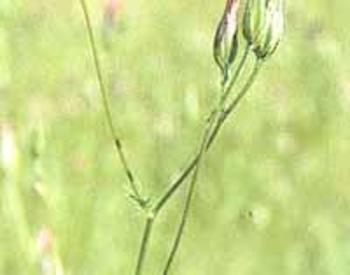
What, uh, what techniques or what things might they do? Yeah, I mean, so just thinking, um, you know, year to year we talk about promoting perennials, uh, perennial bunch grasses. Those are our native grasses. And, um, the research shows that these are more resistant, or sorry, these create more resistance to invasion by annual grasses.
If you have an established perennial bunch grass component. Um, the other thing is they also reduce crazy fire behaviors. So kind of natural fuel arrangement of these bunch grasses is you actually have bare inner space between these plants. And so, I mean, yeah, you might have a crazy wind day, but in general you can have more kind of meandering fires that mimic our natural fire then then if you have just this terrifying continuous fine fuel bag created by those annual grasses.
Also, you know, close to your home or around important infrastructure, we typically, um, suggest that maybe people manage their hazardous fuels. So on rangelands, those are gonna be, uh, your sage brush and, and western juniper.
Um, due to the chemical composition and the leaves, those are highly volatile. And so if, um, if fire reaches them, they're, they're definitely gonna put off, um, quite a lot of heat. We've seen increased fire severity around sagebrush. An example, a study here at the EOARC found that there was 90% bunch grass mortality around the drip line of burning sagebrush. So that's the immediate perimeter. And the reason that's important is that when you kill your bunch grasses, going back to the annual grass problem, that increases the likelihood you have that bare soil, um, that that area could be colonized in transition to annuals.
Uh, but you know, maybe just to step back up my back on my soapbox. Um, yeah, important to treat your fuels around your home. We do want resilient rangelands. Uh, it's beneficial to, um, livestock operators as well, to have a bunch grasses, but it, when I think of fire resilience, it's not on an individual, right? It's an entire, um, community. Again, it's at that landscape level where fires occur.
And so for me, fire resilience, yeah, it's nurturing. You know, perennial bunch grasses, um, resilient ecosystems, but it's also people working together to reduce their risk. Um, again, enhancing resilience through actions, treating invasives, um, having effective fire response plans, um, and then also being ready to deploy post fire in places that are strategic and that are most effective to, again, Contributing to that vision of overall landscape resilience to fire.
And so I, I don't think I've rambled about this yet, Jake, but you know, post-fire restoration is a whole, is a whole thing in this space, which is we have such large fires in on on Rangelands. Um, you know, an example in 2012, we had the Long Draw and Holloway fires in the same summer, those fire perimeters nearly touched each other in southern Malheur county, and they burned together over a million acres.
You can't restore a million acres of Rangelands that, that was just one state, right? It was there were other big fires that year, and so going back to enhancing Rangeland resilience. It's also making, um, strategic decisions about our post-fire restoration. So where are the most important places we reseed?
Where are the most important places that we spray and try and exclude annuals? And so going back to our strategic planning framework. It's kind of thinking through where are currently resilient rangelands, those core rangelands I mentioned. Where are those growth opportunities? Um, we've also mapped where we have abiotic resilience and resistance.
So that's, um, characteristics of the soil, slope, precipitation. And then also biotic resilience and resistance. And so those tell us something about how likely a site will be invaded by annuals. And so, you know, a shorthand decision is where we have low resilience and resistance. You're probably not gonna be that successful with post-fire restoration.
And so maybe you should prioritize those areas around core where you might have greater success, where there might be higher r and r. I think that was really well said, Katie and I, I don't think that we have the time today to try to solve a lot of these issues, although we could certainly try, but I wanna make sure we don't miss anything or if you had something that you wanted to, uh, share your thoughts on before we, uh, start to wrap up here.
Um, I'll just say, I should make a hat or something. Um, fire resilience benefits everyone. What, it's, it's a public good. And so what that means is we all benefit from it, but what that means if is, if we're not all contributing to it. It means that we are affecting everyone. And so I, I bring that up as my parting thought because that's why, yeah, we can, you know, treat fuels on our range lands.
Um, do do some good projects, maybe treat some invasives, but it also matters what everyone else at this landscape scale, the scale of wildfires is doing. So, use, use strategic planning tools to do that. Um, you know, think about working with your neighbors, um, your local organizations like Soil & Water Conservation Districts, NRCS, um, they can be really useful for kind of piecing together these different activities.
But we, we can't keep, um, you know, thinking we're managing this complicated ecosystem, um, in a vacuum. Well, I certainly learned a lot and certainly didn't realize that 42%, is that what you said is covered in rangeland in Oregon? Yes. That I did not realize that. I see the range all the time, and I think about range a lot, but I didn't realize it was 42%.
Uh, well, thank you Katie, so much for sharing your expertise with us today and for sharing how important these are. And I, I certainly learned, uh, how similar some of the issues are when it comes to natural resource management, which I guess I shouldn't be too terribly surprised about. But if you had any questions that came up today while you were listening, or if you'd like to learn more, please drop us a comment or send us a message on our website.
Uh, before we wrap up here, Katie, we like to conclude each episode with what we call our lightning round or a few questions that we ask each of our guests.
So I'm sure you're gonna be very excited about this one because the first question is, what is your favorite tree? And you can't say Wyoming sagebrush. Oh, come on. So, so I was on your podcast, uh, a while ago when you all talked with the fire team and my friend who ranches in Mountain Home, Idaho. Hello, Charlie.
He heard me say sagebrush and just giggled with glee at this. Um, so Jake. What if I, what if I just can't bring myself to say another tree? Okay, what is your favorite rangeland plant then? Shrub. herb, forb, grass? No, I mean, I'm not, I'm, I'm not being, um, I'm not being coy. I I really like sagebrush. Um, just the smell of sage, right?
When you like, you know, run some over and, and get it crushed. Like, I just love that when it rains, it's, it's magical. Um, I have some in my backyard and I, I just like, I like seeing it so it, it's special to me. We're, we're gonna call it a tree today. Thanks for working with me. I can't blame you. All right then, uh, the next question then is, so what is the most interesting thing you bring with you in the field?
Yeah, uh, can I change that to essential, what's the most essential? Essential, yes. Okay. Okay. It's. It's coffee. Coffee. So, so if you're working with me and you, you want me in my best mood? You want me cheerful and pleasant? You're gonna want me to have coffee. I, I can't blame you for that one. There we go. I always bring coffee.
All right. And then lastly, uh, what resources would you recommend to our listeners if they're interested in learning more about all things related to range? Yeah, um, you know, a good place to start might be the Sagegrass Partnerships website, so that's just SageConpartnership.com. Um, and that's an, uh, organization in Oregon, uh, that brings together a bunch of, you know, people in the rangelands space. Um, their mission is to work together to build resilience on Oregon sagebrush rangelands, um, and really thinking expansively about that term resilience in the, in the ways I, I mentioned today. Uh, one really cool tool that they host, um, with Oregon Explorer, um, is the SageCon landscape planning tool. And we've actually used this for some of our, um, strategic planning programming.
Uh, I talked a lot about how we need to be thinking about how our individual activities translate to the landscape scale. And so if you go to the SageCon landscape planning tool, um, you can click on and off a whole lot of different layers. Um, we've, uh, they've mapped what we call eco states on, on Rangelands in Eastern Oregon.
And so those are the different, um, plant communities. And, and so like I said, this is where, um, those concepts of core Rangelands come from. And so it's a really cool way to visualize, um, how all these different pieces fit together. The other resource, you know, if you're, if you're into plants, um, just looking at vegetative production, some of you might be familiar with the rangeland analysis platform.
It's produced, uh, by the University of Montana. It's hosted by the USDA Agricultural Research Service. Um, and it provides cover maps of major rangeland vegetation functional groups, uh, across the Western US, uh, and so it, uh, is very comprehensive. You can look at annual forbs and grasses, perennials. A more recent product has actually been, um, fire probability maps for the Great Basin.
So I pulled up the 2023 one. Um, it's looking like a relatively tame year, but as I said, we, we never know because of that fine fuels production. So those are a couple fun things to look at if, if folks are interested. Well, Katie, it's great to see you. Thank you again so much for being here today. I, I definitely learned a ton.
You are a wealth of knowledge when it comes to these topics, so thank you for sharing your expertise. Well, everyone, this concludes another episode of In the Woods. Thank you all so much for listening. Don't forget to subscribe and we will see you all next time. Bye everyone.
Thank you so much for listening.
Show notes with links mentioned on each episode are available on our website in the woods podcast.com. We would love to hear from you. Visit the tell us what you think, tab on our website to leave us a comment, suggest a guest or topic or ask a question that can be featured in a future episode, and also give us your feedback by filling out our survey.
In the Woods was created by Lauren Grand, Jacob Putney, Carrie Berger, Jason O'Brien and Stephen Fitzgerald, who are all members of the Oregon State University Forestry and Natural Resources Extension Team. Episodes are edited and produced by Kellan Soriano. Music for In the Woods was composed by Jeffrey Hino.
And graphic design was created by Christina Friehauf. We hope you enjoyed the episode, and we can't wait to talk to you again next month. Until then, what's in your woods?
In this episode, Jacob Putney is joined by Katie Wollstein to discuss strategies to mitigate fires and invasive plant species in Oregon rangelands.