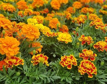
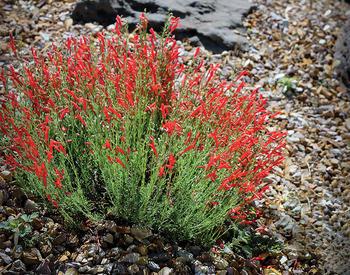
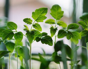
Behind the beauty of the High Desert landscape lie many factors that create challenges for gardeners. Some of the main factors that contribute to difficulties include temperature, precipitation, soil types, elevation, USDA hardiness zones and microclimates. Learning how to work with these challenges can allow you to have a successful and beautiful garden.
What zone are we in?
What is a hardiness zone or rating, and what zone is Central Oregon considered?
The term “hardiness” refers to the ability of a plant to withstand an average minimum temperature. Oftentimes, when we go to purchase plants, the catalog or plant tag will indicate hardiness zone followed by a number. This number is based upon the hardiness zones derived from a map put out by the by the U.S. Department of Agriculture. The map is based on the average annual minimum temperatures recorded throughout North America from 1974 to 1986.
There are 11 designated zones, with 1 being the coldest climate and 11 being the most temperate zone.
When choosing a plant, pick one with a rating that falls within your zone, or one zone colder. For example, if your area is designated as hardiness zone 4, purchase plant material hardy to zone 4 or less, such as zone 3.
There are other climate zone or hardiness maps in existence, but these are not used universally, as is the USDA Hardiness Zone map. An example would be the climate zones (which is different than a hardiness zone) designated by the popular Sunset Western Garden Book. Sunset's climate zone information, although very informative, will not be designated on plant tags or in catalogs.
Hardiness ratings or zones are intended to be used only as a guide, not an absolute for plant selection and survivability. That is especially the case here in Central Oregon, where we have several microclimates.
A microclimate is the climate of a small area (for example, your backyard or even a portion of your backyard), as opposed to that of a larger region. Some of the factors that determine a microclimate include cold pockets, hills and the location of houses or other structures.
There are numerous factors that contribute to whether or not a plant will survive besides minimum temperatures. Some of these factors include soil type, rainfall, heat tolerance and exposure to wind and sun. According to the USDA Hardiness Zone map, Central Oregon is placed in Zone 6 (–10 degrees Fahrenheit to 0 degrees Fahrenheit). However, this is really oversimplified given our many microclimates. The following chart is a more accurate guide to use when looking at plant hardiness for Central Oregon. Just remember to think about microclimates within your own landscape.
Use this hardiness zone guide in selecting plant material for your landscape.
| Location | USDA hardiness zone |
|---|---|
| Bend | 3–5 |
| Crooked River Ranch | 4–5 |
| Culver | 4–5 |
| La Pine | 3–4 |
| Madras | 4–5 |
| Prineville | 3–5 |
| Redmond | 3–5 |
| Sisters | 3–5 |
| Sunriver | 3–4 |
| Terrebonne | 4–5 |
| Tumalo | 3–5 |
| Warm Springs | 4–5 |
Soils
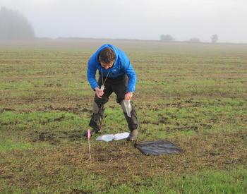
Most Central Oregon soils are coarse with a sandy texture, and tend to be sterile with minimal organic matter. These soils need to be amended with organic material such as compost or aged manure to improve water-holding capacity, increase microorganism activity levels, and improve the overall health of the soil. The soil pH is generally between 6.0 and 7.0, which is neutral, and suitable for most plants. In some areas, the soil may be a bit more alkaline (pH above 7.0) and require soil amendments to reduce the pH. A soil test is beneficial in determining soil pH and the nutrient analysis of your soil.
Precipitation
We often think of precipitation in terms of rain. However, here in the High Desert, our natural precipitation ranges from 8–22 inches per year, most of which falls during winter as snow.
| Month | Bend | La Pine 2 | Madras | Prineville | Redmond | Sisters |
|---|---|---|---|---|---|---|
| January | 1.53 | 3.05 | 1.30 | 1.12 | .97 | 1.89 |
| February | 1.09 | 2.48 | .96 | 1.00 | .65 | 1.31 |
| March | .73 | 1.78 | .81 | .87 | .66 | .98 |
| April | .78 | 1.31 | .92 | .87 | .73 | .95 |
| May | .89 | 1.23 | 1.01 | 1.17 | 1.02 | 1.21 |
| June | .70 | 1.07 | .68 | .92 | .64 | .86 |
| July | .56 | .71 | .54 | .56 | .53 | .53 |
| August | .48 | .75 | .34 | .34 | .50 | .44 |
| September | .41 | .65 | .41 | .38 | .41 | .48 |
| October | .60 | 1.37 | .85 | .83 | .65 | 1.05 |
| November | 1.39 | 3.05 | 1.25 | 1.18 | .96 | 1.86 |
| December | 2.20 | 3.87 | 1.38 | 1.44 | 1.16 | 1.97 |
| Year | 11.36 | 21.32 | 10.45 | 10.68 | 8.88 | 13.53 |
Elevation
Central Oregon increases in elevation as you go from north to south. The elevation in Warm Springs is 1,000 feet, increasing to 4,200 feet in La Pine. Higher elevations tend to have winters that are longer and colder. Other effects of higher elevations include lower night temperatures, especially during the growing season, and increased intense sunlight year-round.
| Location | Elevation (feet) |
|---|---|
| Bend | 3,650 |
| La Pine | 4,200 |
| Madras | 2,230 |
| Prineville | 2,840 |
| Redmond | 3,060 |
| Sisters | 3,180 |
| Sunriver | 4,156 |
| Warm Springs | 1,000 |
Temperature
Many people are attracted to Central Oregon because of the large number of sunny days we experience here. Interestingly enough, these sunny days are responsible for the occurrence of radiational cooling, resulting in frost any time of the year.
Historically, there are less than 10 frost-free days (32°F or greater) in the city of Bend. These dates occur during July and August.
The higher elevations are especially susceptible to frost and can experience frost during the summer months.
Established plant material in the landscape will suffer frost damage at temperatures of 24°F or below. More tender plants will freeze between 24°F and 32°F.
Central Oregon’s climate has a wide range of temperature extremes between day and night. These temperature fluctuations often cause plants to bud out prematurely, only to get nipped by frost at a later date.
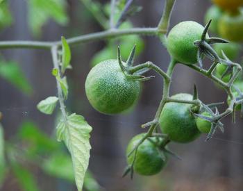
Relatively low evening temperatures limit plant growth and the production of some heat-loving crops such as tomatoes, peppers, eggplant and melons.
Our spring and autumn months do not warm up and cool down gradually, which is often the case in more temperate regions. The growing season ranges from 60 to 120 growing days, with the shorter seasons occurring in the higher elevations and southern regions of Central Oregon such as La Pine and Sunriver.
We also experience many microclimates here in Central Oregon. Microclimates can influence plant adaptability in your own backyard and should be considered when selecting plant material. The growing season or time during the year where you can achieve plant growth varies each year due to our low evening temperatures and the frost factor. However, we can approximate the number of days you generally have to grow plants during the growing season, based on averages taken over the years.
| Location | Average growing season (number of days) |
|---|---|
| Bend | 80–90 |
| La Pine | 70–80 |
| Madras | 90–100 |
| Prineville | 80–90 |
| Redmond | 80–90 |
| Sisters | 75–85 |
| Sunriver | 70–80 |
| Warm Springs | 100–110 |
| Location | Last occurrence in spring of 24°F | Last occurrence in spring of 32°F | First occurrence in fall of 24°F | First occurrence in fall of 32°F |
|---|---|---|---|---|
| Bend | May 10 | June 20 | Oct. 15 | Sept. 2 |
| LaPine 2 | April 30 | June 20 | Oct. 11 | Sept. 8 |
| Madras | April 16 | May 27 | Nov. 1 | Oct. 3 |
| Prineville | May 5 | June 28 | Oct. 3 | Aug. 31 |
| Redmond | May 5 | June 17 | Oct. 17 | Sept. 9 |
| Sisters | May 23 | July 10 | Sept. 20 | Aug. 17 |
| Month | Bend | La Pine 2 | Madras | Prineville | Redmond | Sisters |
|---|---|---|---|---|---|---|
| January | 32.7 | 29.6 | 32.5 | 34.1 | 32.7 | 31.7 |
| February | 34.2 | 31.8 | 35.4 | 37.4 | 35.2 | 33.8 |
| March | 39.3 | 36.8 | 41.1 | 42.3 | 39.9 | 39.5 |
| April | 43.6 | 41.7 | 45.6 | 46.6 | 44.4 | 44.0 |
| May | 50.5 | 49.0 | 52.7 | 53.9 | 51.4 | 50.7 |
| June | 57.1 | 56.0 | 59.4 | 60.3 | 58.5 | 57.1 |
| July | 64.5 | 63.7 | 65.9 | 66.9 | 65.9 | 64.3 |
| August | 63.8 | 62.8 | 65.0 | 66.0 | 65.0 | 63.6 |
| September | 56.5 | 55.8 | 57.6 | 59.0 | 57.2 | 56.1 |
| October | 47.3 | 46.0 | 47.2 | 49.3 | 47.4 | 46.4 |
| November | 37.6 | 35.6 | 38.3 | 39.6 | 37.4 | 37.0 |
| December | 31.1 | 28.6 | 30.8 | 32.3 | 30.6 | 30.0 |
| Year | 46.6 | 44.9 | 47.7 | 49.0 | 47.2 | 46.3 |
| Month | Bend | La Pine 2 | Madras | Prineville | Redmond | Sisters |
|---|---|---|---|---|---|---|
| January | 41.1 / 24.3 | 39.3 / 19.9 | 41.8 / 23.3 | 42.8 / 25.4 | 42.4 / 23.1 | 40.6 / 22.8 |
| February | 44.3 / 24.2 | 42.8 / 20.8 | 46.4 / 24.4 | 48.0 / 26.8 | 46.8 / 23.7 | 44.3 / 23.3 |
| March | 51.0 / 27.5 | 48.3 / 25.3 | 54.3 / 28.0 | 54.7 / 29.9 | 53.8 / 26.0 | 51.7 / 27.4 |
| April | 56.7 / 30.4 | 54.4 / 28.9 | 60.6 / 30.7 | 60.8 / 32.5 | 59.6 / 29.1 | 58.4 / 29.6 |
| May | 64.6 / 36.3 | 63.1 / 34.9 | 68.6 / 36.8 | 68.5 / 39.2 | 67.5 / 35.4 | 66.4 / 35.1 |
| June | 72.3 / 41.9 | 71.4 / 40.6 | 76.2 / 42.6 | 76.4 / 44.2 | 76.1 / 41.0 | 74.6 / 39.5 |
| July | 81.5 / 47.5 | 81.7 / 45.7 | 85.3 / 46.6 | 85.9 / 47.9 | 85.6 / 46.2 | 85.1 / 43.5 |
| August | 81.3 / 46.3 | 81.6 / 43.9 | 84.7 / 45.3 | 85.4 / 46.6 | 84.8 / 45.2 | 84.5 / 42.8 |
| September | 73.5 / 39.5 | 74.4 / 37.2 | 76.4 / 38.8 | 77.9 / 40.1 | 76.2 / 38.2 | 75.8 / 36.4 |
| October | 61.9 / 32.8 | 61.6 / 30.4 | 63.4 / 31.0 | 64.9 / 33.6 | 63.5 / 31.3 | 62.6 / 30.2 |
| November | 47.3 / 27.9 | 45.3 / 25.9 | 49.3 / 27.3 | 49.8 / 29.4 | 48.9 / 25.8 | 47.4 / 26.5 |
| December | 39.4 / 22.7 | 37.6 / 19.6 | 39.8 / 21.8 | 40.9 / 23.8 | 40.5 / 20.7 | 38.9 / 21.2 |
| Year | 59.7 / 33.5 | 58.6 / 31.2 | 62.3 / 33.1 | 63.1 / 35.0 | 62.2 / 32.2 | 60.9 / 31.6 |
Tips for cold-climate gardening
Here are some basic tips to extend the growing season in your area and to help you find ways to successfully garden. OSU Extension provides more than 70 other garden publications available to you at little to no cost.
- Use season extenders such as row covers (to prevent frost damage), Walls-O-Water (for tomatoes), cold frames and greenhouses.
- Water during periods of winter drought if the ground is warm enough to accept water. Every six to eight weeks, give your plants a deep soak to prevent winter desiccation.
- Mulch around your perennials to insulate them for the winter.
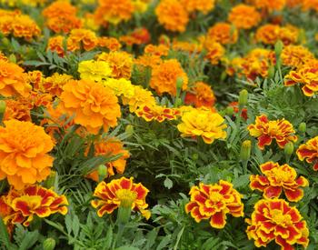
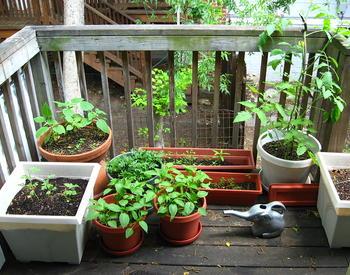
- Select adaptable plant material for your areas and be sure to put the right plant in the right place. Consider mature size, light and water requirements of the plants you select.
- Protect plants from wind by planting a windbreak or planting on the east side of your home.
- Add 14 days to the number of days given for maturation on the seed packet for direct-seeded vegetables and flowers due to our cool evening temperatures.
Sources
- Bauer, M. 1994. The Central Oregon Climate.
- Sunset Western Garden Book. 2001. Sunset Publishing Corp.