Innovations in unmanned aerial vehicles (UAVs) have made it possible to survey our own properties. Collecting images from UAVs using hobby- or professional-grade systems and special software can provide useful information about our forests and rangelands. There is still progress to be made in understanding potential applications, possible users, and best management practices. Also, because this is a new and emerging technology, small-acreage landowners intent on surveying their own properties may have technological questions and concerns to address, and should stay aware of important regulatory issues.
The goal of this publication is to familiarize potential users with the types of UAVs and sensors, share some ideas for application, provide an overview of the relevant laws and regulations, and address some of the challenges that may be encountered.
Platforms
There are two types of UAV aircraft to choose from: fixed wing and rotorcraft. Just like conventional airplanes, fixed wing UAVs use wings fixed to a fuselage to achieve vertical lift and propellers to produce forward thrust. They offer some notable advantages over a rotorcraft, including longer flight times and greater area covered in a flight.
Like helicopters, rotorcraft use spinning propellers to generate lift. They come in many shapes and sizes with different numbers of rotors (typically between 4 and 8). Since they are capable of hovering, they are the optimal method for capturing detailed information on a specific area.
Both types of UAVs have potential autopilot options to aid in planning, mapping, and monitoring. Although autopilot systems are not required, they greatly expand the capacity and flexibility of a UAV by allowing for comprehensive coverage and repeat collections over the same area, as well as preflight planning of the area to collect image data.
Cameras and sensors
Many hobby-grade UAVs have built-in cameras and video cameras, which are more than adequate for ordinary photography. In addition, these can often be controlled and viewed live through your cell phone, tablet, or the video screen on the flight controller.
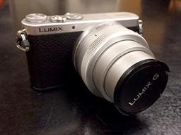
For more detailed mapping applications, a typical compact digital camera is often sufficient. The camera should be light and small, with at least 10-megapixel resolution and a built-in intervalometer (the ability to take pictures at a preset time interval). A built-in GPS is also useful.
Applications
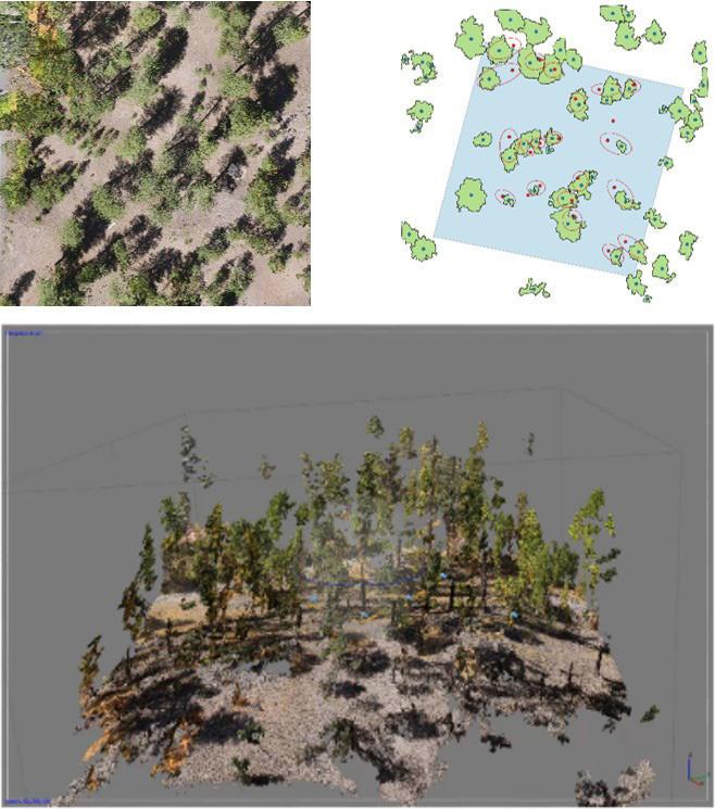
Mapping landscape features (such as topography, streams, and vegetation) and monitoring change are two high-priority applications for which UAVs are uniquely suited. For example, using UAV mapping technology, you can create a map of your property or monitor for forest pest activity.
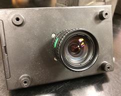
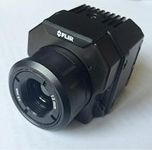
For advanced work, it is possible to purchase a modified camera (or have one modified) so that it can collect images in the near-infrared—wavelengths of light that are too long for our eyes to see. A Normalized Difference Vegetation Index (or other vegetation mapping techniques) can be calculated from images that include near-infrared measurements. Near-infrared measurements can reveal information about vegetation health, tree vigor, and environmental conditions influencing growth.
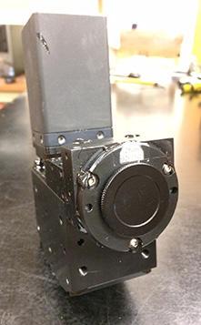
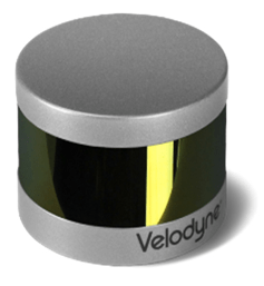
For more specialized results, multi- or hyperspectral sensors can be used to map individual plant species and identify nutrient limitations and other stress conditions. These sensors divide visible and near-infrared light into small slivers or bands that offer further insights about the health and properties of forests and vegetation. Active sensors—such as Light Detection And Ranging (LiDAR), a remote sensing system that emits pulses of light to measure distances to reflecting surfaces—can be used to map terrain and vegetation height. However, these sensors are often expensive.
More affordable sensor solutions, such as point-and-shoot cameras, can be operated with time-lapse settings to collect images over an area of interest. Specialized software can ‘stitch’ the individual photos together into a single image, and the resulting maps can be used to locate roads, streams, general stocking levels and tree density, and, in some cases, can be useful for mapping forest types.
In practice
Suggestions for a successful flight:
- Choose the right equipment. Moderately priced platforms with built-in cameras are available at hobby stores and are sufficient for many applications, including some mapping.
- Plan your flight ahead of time and take into account the limits on your operational range and duration in terms of battery life. An organized flight plan will also make it easier to sort through your imagery afterwards.
- Include objects on the ground that can be used as easily distinguished ground control points (GCPs) of known dimensions (for example, frames made of PVC piping).
- Consider your visualization goals. Pointing the camera directly downward is effective for producing top-down orthophotos (aerial images processed to correct any distortion). Angling the lens can be best for 3D models.
Another option to consider is hiring someone to collect imagery for you. Finding a company will vary by location, and currently only a few companies offer this type of service in Oregon. However, this is likely to change. To explore options, visit http://www.soaroregon.com/
Regulations and legal and ethical issues
Federal rules and regulations
In 2016, the Federal Aviation Administration (FAA) introduced regulations for UAV use:
- Hobby-use does not require a license if the UAV meets size and use requirements (https://www.faa.gov/uas/getting_started/fly_for_fun/).
- Use for commercial purposes (including tree inventory and vegetation assessment for ranching) may require additional certifications and be subject to additional regulation.
- It is illegal to fly within 5 miles of an airport without first notifying the airport and air traffic control. Airports include helipads.
- Temporary flight restrictions do occur, such as during forest fires and emergency situations. It is important to be aware of these. A great resource is the FAA’s B4UFLY smartphone app.
- You must register your UAV with the FAA if it weighs over 0.55 pounds and you are not operating under the Special Rule for Model Aircraft described at the website in the first bullet point. For more information, visit https://www.faa.gov/uas/.
State rules and regulations
- Operating any aircraft over 0.55 pounds requires an FAA license.
- Additionally, all pilots operating or based in Oregon must register with the Oregon Department of Aviation (ODA).
- All aircraft operating in Oregon must be registered with ODA regardless of commercial status. The process is similar to car registration, requiring little more than your name, address, and FAA license number.
- It is illegal to operate UAVs while “under the influence,” or “in a careless or reckless manner.”
Lastly, always be considerate of the privacy and rights of your neighbors. Obtain permission from affected parties before you fly, and communicate regularly throughout operations.
Mark Ducey, professor, Natural Resources and Environment; Michael Palace, associate professor, Earth Science; Franklin Sullivan, research scientist, Earth Systems Research Center; Ethan Blair, research forester, Natural Resources and Environment; all of the University of New Hampshire; Joel Hartter, associate professor, Environmental Studies, University of Colorado; and Paul Oester, Extension forestry agent, Union County, and emeritus professor, Oregon State University.
© 2018 Oregon State University.
Extension work is a cooperative program of Oregon State University, the U.S. Department of Agriculture, and Oregon counties. Oregon State University Extension Service offers educational programs, activities, and materials without discrimination on the basis of race, color, national origin, religion, sex, gender identity (including gender expression), sexual orientation, disability, age, marital status, familial/parental status, income derived from a public assistance program, political beliefs, genetic information, veteran’s status, reprisal or retaliation for prior civil rights activity. (Not all prohibited bases apply to all programs.) Oregon State University Extension Service is an AA/EOE/Veterans/Disabled.